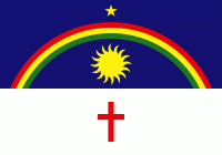
Pernambuco
 |
The contemporary state inherits its name from the Captaincy of Pernambuco, established in 1534. The region was originally inhabited by Tupi-Guarani-speaking peoples. European colonization began in the 16th century, under mostly Portuguese rule interrupted by a brief period of Dutch rule, followed by Brazilian independence in 1822. Large numbers of slaves were brought from Africa during the colonial era to cultivate sugarcane, and a significant portion of the state's population has some amount of African ancestry.
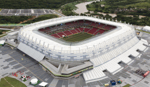
The state has rich cultural traditions thanks to its varied history and peoples. Brazilian Carnivals in Recife and the historic colonial capital of Olinda are renowned: the Galo da Madrugada parade in Recife has held world records for its size.
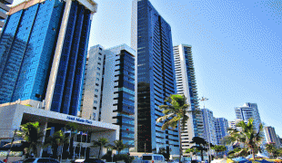
Historically a center of sugarcane cultivation due to the favorable climate, the state has a modern economy dominated by the services sector today, though large amounts of sugarcane are still grown. The coming of democracy in 1985 has brought the state progress and challenges in turn: while economic and health indicators have improved, inequality remains high.
The origins of the name Pernambuco are debated, though most hypotheses derive the name from the now-extinct Tupi language.
Some scholars claim that the name comes from the combining of the Tupi words para'nã, meaning "great river" or "sea" and buka, meaning "hole". Thus, pernambuco would mean "hole in the sea", possibly referring to the Canal de Santa Cruz on the Island of Itamaracá, north of Olinda, or to an opening in the reefs between Olinda and Recife. According to others, pernambuco was the name of brazilwood in local indigenous languages at the time of first contact, as the tree is found widely in the forests of the future state. A third hypothesis also derives from a Tupi word, paranãbuku, meaning "long river", a possible reference to the Capibaribe River, since primitive maps mark such a "Pernambuco river" north of Cabo de Santo Agostinho, south of Recife.
A proxy evolution regarding the life path of Duarte Coelho, the founder of Olinda, suggests that the original name Para-Nambuco, here in two words is the following combination: "Para" denoting an indigenal origin, similar to Paramaribo, Belém do Pára and many others; and "Nambuco" expresses the notion of Southern-Joint, in Malayan language, a maritime key-idea coined in Malacca, where he had been leaving for decades, a long-stay which have allowed him, and the crew to think this way, in an original context of foundation. Olinda is in terms of coastal navigations, the beginning of the south coast of the South American land mass, nearby the Eastern most local of the shoreline, the Cape Branco. Knowing also that they informally, often called to female indies "chinesinhas" due to the similarity of eyes and face, this deportugalised group of founders, portraying a heavy world experience, have preferred the unstudied term Pernambuco, over the portmanteau of non-European languages Para-Nambuco.
Another hypothesis, suggested by the academic Jacques Ribemboim, asserts the origins of the name from the Portuguese language. The Canal de Santa Cruz in Recife, at the beginning of the 16th century, was known as Boca de Fernão (named after the explorer Fernão de Noronha). The Indians may have pronounced Fernão as Pernao and reversed the order of the words, giving Pernão Boca or Pernambuka, leading to the contemporary name of Pernambuco.
The state also has some nicknames, such as Lion of the North, Land of Frevo and Maracatu and Blessed Land.
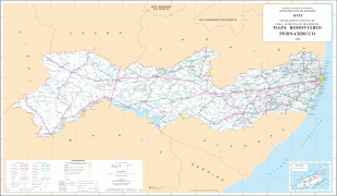
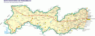
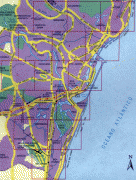
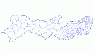
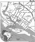
Map - Pernambuco
Map


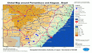
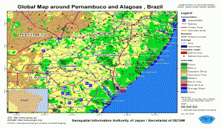


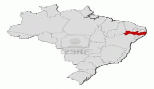

Country - Brazil


Currency / Language
| ISO | Currency | Symbol | Significant figures |
|---|---|---|---|
| BRL | Brazilian real | R$ | 2 |
| ISO | Language |
|---|---|
| EN | English language |
| FR | French language |
| PT | Portuguese language |
| ES | Spanish language |


